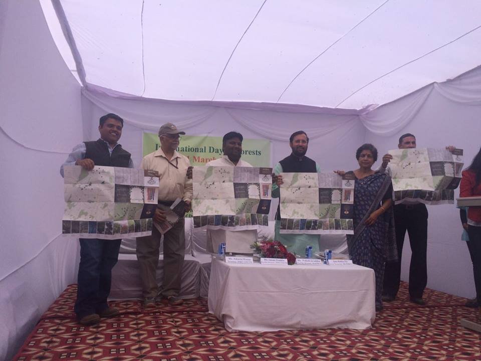
Delhi’s tree-lined roads are one of the best features of the national capital and two organisations in the city want people to take up the responsibility of maintaining their number in the city. They have come up with a unique, and probably the country’s first, tree map.
The Delhi Landmark Tree Map shows the 59 species of the trees located in the central and southern parts of the city. It is accompanied by where one can find the tree, it’s name and other details. And it’s not just names, the map has photographs of each type, so that you can easily tell whether you’re looking at a Acacia or Ashoka tree.
A joint initiative launched by Vertiver and Swapan Iora Ecological Solutions, two environmental conservation organisations based in Delhi, the map was recently launched by Environment Minister Prakash Javadekar.

“Delhi has an approximate 2.1 crore trees with more than 250 different species. We want people to connect with the city’s trees as ecological landmarks. We believe that conservation becomes easier when people begin to value their ecological assets,” says Chhaya Bhanti, founder of Vertiver.
Many officials from the forest department were consulted while making this map.
“IORA’s environmental scientists, GIS experts and researchers with considerable experience in forestry identified and mapped these trees. We consulted with various officials from the forest department during the process. Our teams visited each location, and mapped each tree using a GPS system,” says Swapan Mehra, CEO of Iora Ecological Solutions.
The two organisations haven’t had it easy coming up with the map.
“Creating this tree map was both a research and design challenge. Consulting with various experts to plot the exact locations of the trees, then having our creative team translate the data into a visually compelling design took a few months. We actually never had the time to figure out if ours is a first-ever-initiative,” Bhanti adds.
The project has received no government funding and was funded entirely by the two organisations.
“Government officials were quite helpful in getting us information. Mr. Subash Chandra, a former Director of the Horticulture Department, New Delhi Municipal Corporation (NDMC), played an active role in giving us all the required inputs,” says Mehra.

The groups now plan to bring out more maps which will cover other parts of the city such as the Ridge area near Delhi University, and will include the remaining species of trees. However, what they are working to bring out soon is a mobile app.
“”We will soon launch a forest mobile application through which citizens can connect with ecological landscapes of the cities they are in. The app will be interactive allowing users to contribute with pictures and information to our online database. Technology and informationtools such as these empower citizens to take greater responsibility for their environment,” says Bhanti.
“We also aim to partner with schools to use this map as an experiential learning tool for their students as part of their environmental education programs.”
And the two groups don’t plan to stop with Delhi.
“We chose Delhi as the first city for creating this map because as the capital city it can set a road map for other cities in India to follow. We will be working on updating the map throughout the year and demonstrate its success in Delhi so that we can engage cities across India on creating similar ecological initiatives,”Mehra said.
“Our goal is to engage people actively and interactively in urban ecology. We want people to hold trees as symbols of heritage with the love and respect they deserve,” he said.
(Feature image source: Vertiver)


